Storm Éowyn: Ireland Faces Devastating Winds and Warnings as Chaos Looms
A catastrophic weather event is about to unfold across Ireland, with meteorologists issuing unprecedented warnings and emergency services preparing for potential widespread destruction.
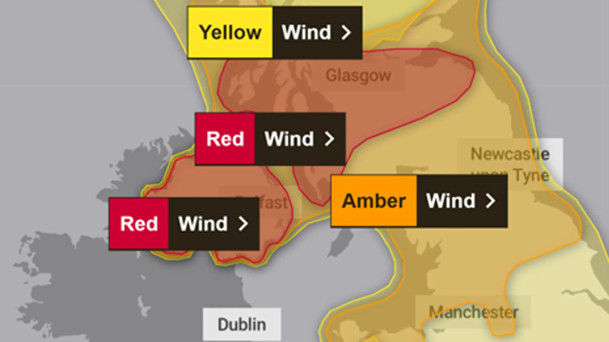
Ireland stands on the brink of one of its most severe weather challenges as Storm Éowyn approaches, bringing hurricane-force winds and an imminent threat to life across the nation. The Met Éireann has issued a rare red weather warning, signaling the extreme nature of the impending storm that is expected to create widespread chaos and potential devastation.
Unprecedented Weather Alert
The storm, classified as an extratropical “bomb” cyclone, is set to unleash wind gusts potentially reaching up to 130 km/h (80 mph), with some locations anticipated to experience even more extreme conditions. The red warning, the highest possible alert level, covers significant portions of the country and will be in effect from 07:00 to 14:00 GMT on Friday, January 24, 2025.
Key Impacts and Warnings
Emergency services are preparing for multiple critical challenges:
- Potential power outages affecting over 560,000 properties
- Extensive transportation disruptions
- Possible structural damage
- Risk to public safety
“This is a danger to life situation,” warned senior meteorological experts. “Residents must take immediate precautions and stay informed.”
Widespread Preparations
Local authorities across Ireland and Northern Ireland have implemented comprehensive emergency response strategies. Schools, colleges, and universities have been closed, and public transport services suspended to ensure public safety.
Critical Recommendations for Residents
Authorities are strongly advising residents to:
- Secure loose outdoor items
- Charge electronic devices
- Prepare emergency supply kits
- Avoid unnecessary travel
- Stay indoors during peak storm hours
Historical Context and Climate Implications
Storm Éowyn is not an isolated incident but part of a growing trend of extreme weather events. Meteorologists suggest this storm could rival historic events like Storm Ophelia in 2017, which caused significant damage and widespread disruption.
Broader Weather Pattern
The storm is being fueled by a significant weather system that has simultaneously caused severe winter conditions in the southern United States, highlighting the complex and interconnected nature of global weather patterns.
Emergency Response Mobilization
Local governments are actively mobilizing resources to respond to potential storm aftermath. Emergency services are on high alert, with teams prepared to:
- Clear debris
- Restore power
- Conduct rescue operations
- Provide immediate support to affected communities
Communication and Updates
The public is urged to:
1. Stay updated through official weather channels
2. Follow local authority guidance
3. Prepare for potential communication disruptions
4. Have battery-powered radios available
Conclusion
As Storm Éowyn approaches, Ireland braces for what could be one of the most dangerous weather events in recent history. The combination of hurricane-force winds, potential heavy rainfall, and possible snowfall creates an unprecedented challenge for residents and emergency services alike.
Stay safe, stay informed, and prioritize personal safety during this extreme weather event.
Last Updated: January 23, 2025
Disclaimer: This article is based on current meteorological predictions and emergency service advisories. Conditions may change rapidly, and residents should continuously monitor official sources for the most up-to-date information.


Leave a Comment